Where the Wall Used to Be
Search for traces: Wall trail, history mile and memorial places
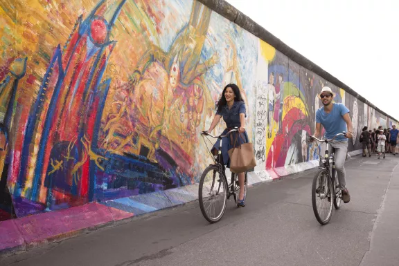
It divided Berlin down the middle. A concrete bulwark that wrote a sad chapter of world history and became a frightful symbol for the divided metropolis. The eastern part of the city was walled up, cut off. In the West, Berliners and visitors from around the world stood on observation towers and gazed over the Wall, while the copious graffiti sought to deprive the gray colossus of its murderous brutality. At the Wall, people died. Fates were decided. And here, in 1987, U.S. President Ronald Reagan demanded, “Mr. Gorbachev, tear down this wall!”
The Berlin Wall, symbol of the division of Berlin and Germany and the Cold War, finally came down on 9 November 1989. The construction of the Berlin Wall on 13 August 1961 led to the partitioning of East and West Germany and West Berlin’s encirclement by the Wall. Hundreds of people lost their lives on the border trying to escape from East to West. Following an escalation of protests at the end of the 1980s, the border crossings were opened on 9 November 1989. That night and over the next few days, millions celebrated across the city: Berliners from East and West and visitors from across the world joyously embraced each other. The peaceful revolution had triumphed and reunited the people of Germany. Berlin has changed dramatically since the fall of the Wall and German reunification: the two halves of the city have once again merged as one, historic buildings have been restored and whole new districts and magnificent buildings have emerged.
What remains of the Wall? Where can the concrete remnants, reminders of the Wall, still be found, except in New York, Brussels, and in hundreds of thousands of private display cases? The search is laborious, because most of the remains of the Wall were torn down and destroyed in the heady excitement and turbulence of the post-East German period. The Berlin State Senate has now developed a comprehensive plan which, in the coming years and in conjunction with existing projects, will restore the possibility of a visible remembrance of the era when Berlin was a divided city.
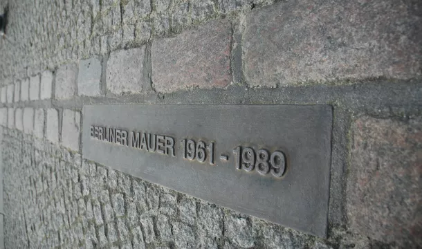
The course of the over forty kilometer-long urban border is no longer documented “continuously” in the current cityscape. Double rows of cobblestones now mark the course of the Wall over 5.7 kilometers in the center of the city. At certain intervals, there are metal plaques in the ground bearing the inscription: “Berliner Mauer 1961–1989” (Berlin Wall 1961–1989). A double row was chosen because the Wall was (almost) everywhere a double wall: the Grenzmauer or border wall abutting West Berlin and the Hinterlandmauer, the wall facing East Berlin. The row of cobblestones is not without gaps, however. Some of the “Berlin Wall stones” were long ago built over with houses, buildings, etc. In certain areas, nature has reclaimed the land. And the cobblestone marking is also absent wherever the land of the former Mauerstreifen, the military zone between the two sides of the Wall, is now in private hands (again). It is easy to find, though, at the Brandenburg Gate and the Potsdamer Platz.
Berlin Wall Trail
The Berlin Wall Trail marks the course of the former East German border fortifications around West Berlin. It extends for about 160 kilometers around the western half of the city. In most sections, the cyclist and pedestrian path runs along the Zollweg road (West Berlin), or the Kolonnenweg, which the East German border guards had built for their patrols in the Todesstreifen [death strip], the militarized zone between the inner and outer walls. Historically interesting sections, where remains or traces of the Wall can still be found, alternate with charming natural settings.
The trail has signs posted along the way. At regular intervals, there are maps that provide an overview and help visitors orient themselves. In addition, there are forty points supplying information in several languages about the division of Germany and the construction and fall of the Berlin Wall. Photographs and text relate the story of particularly dramatic events that occurred at a particular site and recall both the political situation and everyday life in the divided city.
To facilitate the planning of bicycle tours or trips on foot, the Berlin Wall Trail is divided into fourteen individual sections. Each is between seven and twenty-one kilometers in length. The beginning and ending points of all the stages can easily be reached with the local public transit system. Moreover, it is always possible to take a bicycle on board the subway, commuter rail, and regional trains in Berlin.
A multimedia guide for the Berlin Wall Trail is available. With this ”MauerGuide”, visitors will be led from station to station via GPS signals, allowing them to easily follow the course of the former Wall. Via finger touch on the color screen of the minicomputer a voice is presenting the Berlin explorer historical facts, scientifically proven background information and reports of contemporary witnesses. The guide can be rented from several central locations on the trail (at Checkpoint Charlie, the Brandenburg Gate, Bernauer Straße, Niederkirchner Straße) and is available in German and English language. It costs either 8 euros for four hours or a maximum of 10 euros for the whole day.
Tour 1: Start Potsdamer Platz to Warschauer Brücke
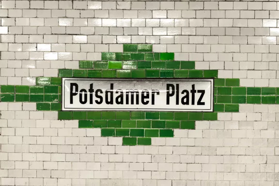
The starting point is what was once the largest and busiest public square in Europe, the spot where the two halves of Berlin that were divided for 28 years by the Wall have now grown back together. And by heading southeast, you can experience some of the history of the Wall “live” on a route over seven kilometers long. At the Potsdamer Platz itself, the period of division is recalled by a temporary exhibit, two plaques of the Berlin WallHistory Mile and a watchtower of the East German border patrol, although the latter is currently obscured by new buildings.
Just where the border was situated can be seen more easily at Niederkirchnerstraße and Zimmerstraße, at which roughly 200 meters of the original Wall are preserved at the site of the exhibit “Topography of Terror” (at the Martin Gropius Building). At this point, the marking of the former course of the Wall with the double rows of cobblestones by Angela Bohnen and the copper band of Gerwin Zohlen is also clearly recognizable as the line at which the front portion of the Wall stood. The crumbing condition of the remainder of the Wall is due to the Mauerspechte or “wallpeckers.” These souvenir hunters took part in the rapid demolition of the hated edifice with hammers, chisels, and electric tools in 1989–90.
The route continues past the former border checkpoint for foreign nationals at Friedrichstraße/Checkpoint Charlie. Here, the 15 metre (50 ft) high Berlin Wall Panorama created by famous artist Yadegar Asisi shows a panorama of daily life on both sides of the Berlin Wall on a fictitious autumn day in the 1980s. Asisi, who lived in Berlin Kreuzberg himself in the 1980s, included East German soldiers on border patrol but also graffiti artists, children playing and drunks at a curry wurst stand in his artwork. Audio sequences and voices of contemporary witnesses complement the visual representation and create an authentic atmosphere.
Just a few steps away, the Wall Museum, opened by historian Rainer Hildebrandt on June 14, 1963, presents documentary films, interviews with contemporary witnesses, and an immense number of other exhibits, including original implements used by people to escape from East Germany. The Wall Museum was long considered an island of freedom in the last building immediately before the border. Here, those helping fugitives could watch all movement at the checkpoint through a small window. The plans of those trying to flee were aided, and those who had escaped were always welcome here.
After the Wall Museum, the trail continues to the Peter Fechter Memorial (see below). It is only a short distance from the Axel Springer building to the former border checkpoint at Heinrich Heine Straße. This is where, among other things, postal and freight traffic passed between East and West Berlin. It was also the checkpoint for West German visitors to East Berlin and for accredited diplomats. There are no longer any remains of the former border checkpoint – a discount supermarket has opened on the eastern side of the site.
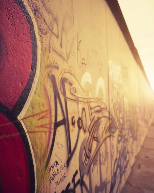
Through Sebastianstraße and Waldemarstraße, the route continues across the Engelbecken pool and the former Luisenstadt Canal. Once the Schilling Bridge is crossed, you arrive at Holzmarktstraße and Mühlenstraße. This is the site of the longest preserved section of the Wall in the Berlin city center. At this point, the inner wall on the East German side consisted, atypically, of neutral white concrete elements, the sort of construction otherwise found only in the outer wall facing West Berlin. The intention was that the border fortifications should look particularly handsome in this area, because the convoys of the guests of state drove over this street from Schönefeld Airport on their way to the center of East Berlin. In 1990, artists from around the world painted the 1.3 kilometer-long remainder of the border wall with striking images. Many of them returned in 2009 to refresh their paintings at the so-called “East Side Gallery”.
Route information: although the City Center Tour from the Potsdamer Platz to the Warschauer Brücke (Warsaw Bridge) is only seven kilometers long, visitors should allow plenty of time (approximately four to five hours) because of the many commemorative sites and memorials.
Tour 2: From Wollankstraße to Nordbahnhof
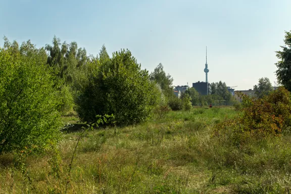
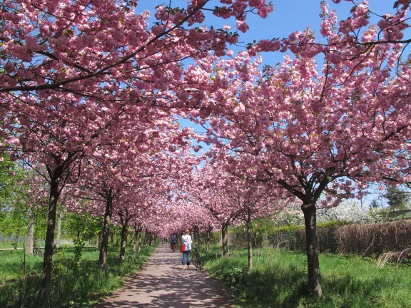
While the Wall still stood, the Wollankstraße commuter rail station was the only intermediate stop on the Nordbahn (train line north) that traveled to Heiligensee and Frohnau. Although it was located across the border, West Berliners were allowed to use this station without checks. For East Berliners it was off limits, however. The jammed route of the East German border patrols led right past the northeast exit. Now the route is marked by surrounding cherry trees and a memorial stone. The trees and the stone are part of a large donation. In 1990, at the first anniversary of the fall of the Berlin Wall, Japanese citizens wanted to congratulate Germany on its reunification by offering this gift. Up at the Bösebrücke bridge, the cherry tree avenue continues.
The commuter rail station Bornholmer Straße was closed when construction of the Wall began on August 13, 1961. The trains to the north of West Berlin passed the station on the western track without stopping. For the trains that traveled to Bernau from the Ost-Ring (East Ring), the East German government had an intercity rail line electrified in 1952, after the closure of the internal German border and the outer ring around Berlin. The route from Schöneweide to Pankow would no longer use the West Berlin Gesundbrunnen station.
During the year that the Wall was erected, East Germany then built its own underground commuter rail line. And as early as December 1961, the section of track that had been known as the “Stalin curve” became an “Ulbricht curve” along which trains clattered directly to Pankow from Schönhauser Allee. From the new walkway between Behmstraße and Mauerpark, you can still see the rear wall that separated these rail facilities near the border from the rest of East Berlin. The Wall Trail leads on across the old Schwedter Straße through the Mauerpark (Wall Park). The park is adjacent to Max Schmeling Hall and Friedrich Ludwig Jahn Stadium, and its current breadth is due to an exchange of land in 1988-89. Graffiti artists regularly let loose in the Wall Park and “occupy” the Wall as they once did in November 1989.
At the end of the Wall Park, the border turned west at a right angle at what is now the three-street intersection of Eberswalder Straße, Oderberger Straße, and Schwedter Straße. Up until the exchange of land, this spot, the beginning of Bernauer Straße, was the site of the highest West Berlin “visitor stand,” where people could gaze, and perhaps wave, over the Wall. It no longer exists today. Bernauer Straße, which the Wall Trail now follows until reaching the Nordbahnhof commuter rail station, still evokes the sadness of events that took place here on August 13, 1961.
Dramatic escapes shocked the world, as people tried to flee from buildings that belonged to East Berlin but were so close to the border that the sidewalk at the front door was West Berlin land. Many commemorative stones and plaques recall dramatic escapes (through tunnels, among other means) at this spot. But the Bernauer Straße of 2010 has hardly anything in common with the same street forty-nine years ago. The “Mauercafe” (Berlin Wall Cafe) offers visitors coffee and pastries. And someone has placed a commemorative plaque on the remains of the Wall.
Once it was possible to permanently forestall the demolition of a long section of the Wall with the death strip at Bernauer Straße, the Berlin Wall Documentation Center was created between Strelitzer Straße and Gartenstraße. This is now the best place in Berlin to get familiar with the border fortifications, as it comprises the Memorial for the Victims of the Berlin Wall, the Chapel of Reconciliation, and the Documentation Center and observation tower. Since the beginning of 2008, there is now also a 70 meter-long Gallery Wall that provides information on plans to expand the Berlin Wall Documentation Center. In addition, fifty large photographs illustrate the changes at Bernauer Straße from 1961, the year in which the Wall was built, to the present. The redesign of the documentation center grounds, which cover 45,000 square meters, is far from complete. The completion will approximately be in 2014.
The Documentation Center is currently closed. After extensive renovation, the re-opening will take place on 9th November 2014. The new permanent exhibition „1961|1989. The Berlin Wall“ will then show the history of the Berlin Wall from its beginnings to the present day.
Route information: From the Wollankstraße commute rail station, the route runs first west of the railway embankment and the former border to Grünthaler Straße, and then, up at the esplanade, travels beneath the underpass, after which it switches to the eastern side of the railway structures. After that, it follows the line of the border beneath the Bösebrücke bridge and across the Schwedter Steg bridge and Schwedter Straße to the Mauerpark (Wall Park).
Commemorative Sites
Berlin Wall History Mile
The Berlin Wall History Mile is a permanent exhibition in four languages. At thirty different stops along the former path of the Wall inside the city, it tells the story of the division of Berlin, the construction of the Wall, and the time of its opening. Photographs and text are used to recount the events that took place at particular sites and offer a portrayal of the political situation as well as everyday life in the divided city.
Along Bernauer Straße, for example, there are four plaques of the Berlin Wall History Mile between Schwedter Straße and Strelitzer Straße. They mark spots where people attempted to escape across the Wall. Some of these attempts ended fatally, like that of Ida Siekmann on August 22, 1961 (Bernauer Straße 48). Others were spectacular, like that of East German border guard Conrad Schumann (corner of Ruppiner Straße and Bernauer Straße), and some were successful, as in the case of fifty-seven people who made it to West Berlin through a 140 meter-long tunnel (corner of Strelitzer Straße and Bernauer Straße).
Two more plaques can be found at the former checkpoint at Invalidenstraße (locations: west of the Sandkrug Bridge, north and south sidewalk). One tells the story of young adults who failed in their attempt to escape with a bus in 1963. The other honors the fate of Günter Litfin who, eleven days after construction began on the Wall, tried to flee from East to West Berlin through the nearby Humboldthafen (Humboldt Harbor).
The checkpoint Sonnenallee is also marked by a plaque as well as a double row of cobblestones (location: north of Sonnenallee, at the corner of Heidekampgraben). The plaque shows what a throng of people gathered at the checkpoint on Easter in 1972, before the Quadripartite Agreement on Berlin went into force, when West Berliners were allowed to travel to East Berlin.
Another stop on the History Mile is located on the bridge over the Britzer Zweigkanal (accessible via the Heidekampgraben park). The information plaque here tells the story of the attempted escape and the death of Chris Gueffroy, who was shot and killed by East German border guards on the southern bank of the canal in February 1989. He was the last victim to have been killed by shots at the border.
At the former (northernmost) checkpoint, Bornholmer Straße, two plaques give an account of the fall of the Wall in 1989 and the former public transit junction (locations: Bornholmer Straße, southeast of the Bösebrücke bridge/traffic island on Bornholmer Straße, west of the Bösebrücke). As it happens, the Bösebrücke is where the last major chapter of the history of the Berlin Wall was written. It was here that the first barrier had to be opened to the West amidst the surging throngs of people on the late evening of November 9, 1989. On the north side of Bornholmer Straße, between the bridge and Björnsenstraße, there is still a two hundred meter section of the part of the Wall that faced East Berlin, the “Hinterlandmauer”.
Parliament of Trees
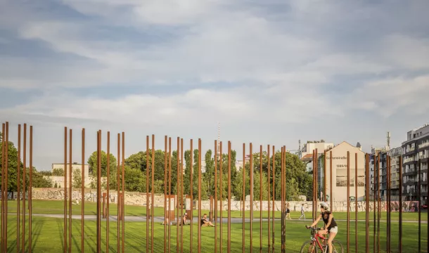
The “Parliament of Trees” is a memorial for those who died at the Berlin Wall. It was laid out by the artist Ben Wagin in 1990 at the former site of the Wall near the Reichstag. The installation of trees, memorial stones, and original pieces of the border fortifications, photos, and text was created by a variety of artists. The names of 258 persons who died at the Wall are inscribed on slabs of granite. The compilation of names is based on what was known at the time, and the list has now been made more precise following a detailed examination of events based on archival materials.
Only some of the segments of the eastern, rear wall that were arranged as a memorial are in their original positions. The “Parliament of Trees” had to be reduced in size for the construction of the Marie-Elisabeth Lüders Building, which holds the library of the German Bundestag.
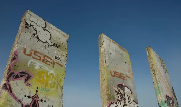
The new installation in the Bundestag building consists of original Wall segments on which Ben Wagin has printed years and the numbers of Wall victims identified for each year. These figures are likewise based on the state of knowledge at the time. On the lower floor of the library, the segments show the former course of the Wall.
Information: Accessible from the Promenade Schiffbauerdamm, Friday to Sunday, 11:00 am - 5:00 pm, admission is free of charge.
The Promenade Schiffbauerdamm runs from Marschallbrücke, where the Wall stood, to Kronprinzenbrücke, which was destroyed in World War II and not rebuilt. The reconstruction of the Kronprinzenbrücke, based on a design by the architect Santiago Calatrava, was one of the first links forged between East and West Berlin territory after the peaceful revolution of 1989-90. Showing the former border is often confusing for this area. The political border line between East and West Berlin, and thus the one of life-and-death importance for fugitives, ran on the south bank of the Spree River on the side of the Reichstag building. But the East German government erected the Wall on the north bank.
Weiße Kreuze (White Crosses) Memorial Site
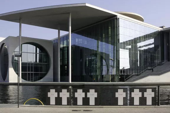
The border fortifications of East Germany ran along the eastern side of the Reichstag building (today the home of the German Bundestag). The southwestern bank of the Spree River belonged to West Berlin, while the water itself was East Berlin territory. At the spot where, until 1990, the outer wall met the riverbank, a private group called the “Berliner Bürger-Verein” (Berlin Citizens Association) set up the memorial site “Weiße Kreuze” on the tenth anniversary of the construction of the Wall in 1971. After the border fortifications had been torn down and new construction took place on the riverbank, the memorial site was set up again in the immediate vicinity of the original site at the Spree. It makes use of seven crosses to commemorate all the people who lost their lives while attempting to escape across the border from East Germany to West Berlin after the Wall had been built.
The history of the White Crosses memorial explains the selection of names for the crosses. Initially, the memorial crosses were set up at the places where fugitives had tried to reach West Berlin and were involved in accidents in the process, or were shot by East German border guards. Over the years, the expense of maintaining the crosses, which were located far from one another, exceeded the means of the Berliner Bürger-Verein. The commemorative tokens were then moved to two central locations, the site at the Spree and Bernauer Straße in the district of Wedding. The crosses will be put up again there, too, in the expanded memorial site.
The plaque of the Berlin Wall History Mile at Reichstagsufer recounts the history of the White Crosses memorial site. At another stop on the History Mile south of the German Bundestag in Scheidemannstraße, visitors can learn about how the Cold War affected the parliament building.
Peter Fechter Memorial
The latest research indicates that 134 persons were either killed while attempting to flee East Germany across the Berlin Wall, or died by other means within the context of the border regime. Some of the locations where such attempts were made are marked by memorials along the path of the former border fortifications. Of these, the Peter Fechter Memorial is one of the most well known.
He was shot by GDR border guards on August 17, 1962, when he tried to climb over the Wall to West Berlin. Badly hurt, Peter Fechter lay dying in the no man’s land at the foot of the Wall without medical assistance. Police in West Berlin were not allowed to intervene. The sentries of the Western allies at Checkpoint Charlie did not intervene either. Though he was bleeding to death, it took an hour before he was removed by East German border guards. On the same day, West Berlin residents who had seen what happened laid flowers and wreaths at the Wall and set up a memorial that still exists today. Every August 13, the anniversary of the construction of the Wall, Berlin residents and political representatives gather here to commemorate those who died at the Berlin Wall.
The memorial on Zimmerstraße in the Kreuzberg district was last altered on August 13, 1999. The simple wooden cross was replaced by a stele created by Karl Biedermann. A basalt marker on the pavement indicates the spot where Peter Fechter died. The stele was donated by Axel Springer Verlag.
Three Berlin Wall Trails on Berlin’s “Outer Ring”
The Wall trails in the city center are spectacular. In many outlying districts of Berlin, on the other hand, one can still see how the “antifascist protection wall”, as it was called by the East German authorities, also interfered in the daily life that played out in areas beyond the world’s attention.
Tour 1: The route from Hermsdorf to Wollankstraße has a bucolic air. North of the stream known as the Tegeler Fließ, the Wall trail leads to the community of Lübars, which has retained its rural charm. It was a farmer from Lübars who, on June 16, 1990, broke through the Wall with his tractor at Blankenfelder Chaussee and thereby reopened that road. Until that day, the connecting road between Blankenfelde and Lübars was still not open, although the Wall had fallen in early November 1989. Today, the spot where the barrier was breached with such determination is marked by a plaque supported by two concrete blocks from the Wall. It is now known as Checkpoint Qualitz, carrying the farmer’s name.
On what used to be the western side of the border, there is a commemorative cross in honor of Horst Frank in Klemkestraße. When he was twenty years old, Frank planned an escape to West Berlin with a childhood friend. At the “Schönholz” cluster of garden plots, they climbed into the no man’s land of the Wall on the evening of April 28, 1962. Around midnight, when they were finally in the midst of cutting through the last fence, Horst Frank was seen by two border guards, who immediately opened fire. He succumbed to his injuries on the same day. His friend reached West Berlin unnoticed.
Route information: The starting point of this fifteen kilometer-long section of the former border is reached by taking the Waldseeweg road from the Hermsdorf/Bahnhofplatz commuter rail station and then following Solquellstraße to Veltheimstraße. The Wall trail can then be seen as it leads eastward to Alte Schildower Straße. By following Kurze Straße, you will reach Wiesenstraße, which runs parallel to the former Wall at Tegeler Fließ. At the approach to Köppchensee lake, the Wall trail takes a sharp turn to the south-southeast toward Blankenfelder Chaussee and Bahnhofstraße. Past the Freizeitpark Lübars – recommended for families with children – you can follow the former Wall all the way to the Wilhelmsruher Damm. The tour can be finished here with a turn west to the Wittenau subway and commuter rail station. The Wall trail continues south to the Nordgraben trench and from there follows the railway tracks to the Wollankstraße commuter rail station.
Tour 2: From Schönefeld to Lichtenrade, another tour covers long stretches of the former border at the outskirts of the city through the relatively unbuilt landscape in the south of Berlin. The former “Kolonnenweg” patrol path of the GDR border guards is preserved in some places here, and there are still some of the old street lamps that lit up the Wall at night. At the Dörferblick, an almost ninety meter-high garbage dump now covered with greenery, the East German border turned to the north at a right angle. It ran towards the panorama of the Gropiusstadt neighborhood and the spot at which there was a hole in the Wall between 1973 and 1977. At the Kölner Damm road, there was a temporary crossing to East Germany that had been set up exclusively for the transport of trash. From there, the vehicles of the municipal waste disposal companies of West Berlin traveled along a fenced-in road to the Großziethen domestic waste landfill.
An information plaque of the Berlin Wall Trail now marks the entrance to the dump, at which approximately 4.4 million tons of refuse were stored over four years. As a city without a surrounding countryside, West Berlin had hardly any capacity for its own garbage dumps and therefore had to rely upon long-term waste-disposal contracts with East Germany during the division of the city. They were continued after 1990 as contracts with the state of Brandenburg. In 1997, the Neukölln-Mittenwalder Railway transported construction waste and excavated soil to Großziethen from the construction sites of the Potsdamer Platz. This was intended to help seal the refuse disposal site, which was later converted into a recreational area. From the Lipschitzallee intersection, the trail continues along Ringslebenstraße to Buckower Damm, where a memorial stone was set up in January 2000 to honor the “non-violent opening of the border” between Großziethen and Berlin-Buckow.
At Rathenower Straße, the line of the Wall turns south again. After Großziethener Straße, a memorial cross for Horst Kullack can be found up at Wittelsbacher Straße. On December 31, 1971, the twenty-three year-old Kullack was shot at without warning while trying to escape across the border. Three weeks later, after multiple operations, he succumbed to his serious injuries in a hospital on January 21, 1972.
The trail can be pursued further by following Kirchhainer Damm (road B96) and continuing past the Lichtenrade commuter rail station to the Mahlow border checkpoint, which was opened in 1977. Here, shipments of municipal waste and building rubble were regularly driven from West Berlin to the Schöneiche dump. The crossing was also used by trucks bringing construction materials to West Berlin. Passenger transport was also allowed in conjunction with travel to the landfill site. A tunnel was built here under the B96 road for the GDR border patrols. Right at the railway track, which was closed down at the time, Eduard Wroblewski died in a hail of bullets from the East German border guards on July 26, 1966. He had tried in vain to reach West Berlin from that point during the evening. There is no memorial site here for Wroblewski, who was thirty-three years old at the time.
Route information: This stage is sixteen kilometers long and particularly well suited for bicyclists. Those who do not wish to complete the whole tour can conveniently shorten it by about a third and turn at the subway station Lipschitzallee. Unfortunately, the train has to make a large detour around the former site of the Wall between Schönefelder Straße and Kleinziethener Weg, at the “Dörferblick”, since the rail line planned on the route of the Wall has not been finished yet. West of Kirchhainer Damm, the trail runs in front of the rail embankment across Paplitzer, Petkusser, Horstwalder and Hilbertstraße until reaching the Lichtenrade commuter rail station about 1.5 kilometers later. It has not yet been possible to create a crossing over the old Dresdner Bahn rail line and the commuter rail track at the path of the former Wall. Sightseers must therefore head for the northern underpass along the Wolziger Zeile road via Paplitzer, Petkusser and Horstwalder Straße.
Tour 3: A tour at the northwest edge of Berlin goes from Staaken to Henningsdorf and begins at the Staaken regional railway station. At this former border railway station for the northern transit route, the East German regime had trains and passengers checked with customs dogs. Along the railway embankment, which was sealed off from the surrounding area by two walls until 1989, the trail continues down the Eichholzbahn road to Finkenkruger Weg.
North of Torweg street, an information plaque tells the story of the Franziskus Church, which stood here in the no man’s land of the Berlin Wall and was torn down on orders of the East German government in 1987. At the end of Finkenkruger Weg, at Ecke Straße 347, there is a memorial cross for Willi Block. After he had fled East Germany twice in 1962 and returned each time, Willi Block was arrested for allegedly engaging in espionage and sentenced to five years in prison in 1963. Released from prison early, he tried to flee to West Berlin again on February 7, 1966 in Staaken. In the no man’s land between the inner and outer wall fortifications, Block was discovered by two border guards and ordered to return. But because his clothing was entangled in barbed wire, he was unable to obey the command. A commander of the 34th NVA (National People’s Army) Border Regiment killed him with a volley from a submachine gun. In 1997, the commander was sentenced to a prison term of three years for a manslaughter offense in the final verdict on the case (Source: Chronik der Mauer).
The trail through the Spandauer Forest leads on to the former West Berlin exclave of Eiskeller (literally “ice cellar”). It got its name because of the consistently low temperatures that made the area a favored storage site for ice from the lake Falkenhagener See. The exclave was connected to the Spandau district by a single access road four meters wide and eight hundred meters long. Three families lived on farms in Eiskeller. Traveling onward, west from Eiskeller, you pass the memorial cross for Adolf Philipp at Oberjägerweg road. From West Berlin, he entered the militarized zone of the Wall for unknown reasons and was shot dead by East German border guards on May 5, 1964.
The trail continues West and eventually reaches the Havel River and the weekend settlements Fichtewiese and Erlengrund.They were likewise situated in the territory of the East Germany as exclaves of West Berlin. The owners of the parcels in these areas had to pass the border fortifications in order to reach their leisure property. At a gateway approached from the direction of the Bürgerablage recreational site, they checked in with the East German border sentry using an intercom system in order to pass the militarized zone of the Wall. After July 1, 1988, there was finally unhindered access to the weekend settlements once more as a result of an exchange of territory with East Germany.
From the former exclaves, the trail follows the Havel River to the northern community of Hennigsdorf. For older West Berliners, the town of Hennigsdorf still calls to mind the “march of the steelworkers.” This protest march on the morning of June 17, 1953, is one of the few West Berlin memories of the uprising in East Germany. To the delight of many residents, the workers of the Hennigsdorf Steelworks and the locomotive plant marched through Reinickendorf and Wedding to the “Haus der Ministerien” (House of Ministries) at the corner of Leipziger and Wilhelm Straße to confront the East German government with their social and political demands. The Hennigsdorf neighborhood of Nieder Neuendorf still has a border watchtower in which a small museum was set up in 1999-2000.
From the end of the river promenade, a bridge is crossed to reach the Oder-Havel Canal and the former Hennigsdorf border crossing, a checkpoint for water-going vessels.
Route information: From the Staaken Regional Railway Station, follow Finkenkruger Weg north to the end of the road and continue in a northeasterly direction across the Falkenseer Chaussee, past the Waldkrankenhaus hospital and into the Spandauer Forest. The main route runs past “Eiskeller”; on the alternative route, you can make a partial detour around the former exclave. At Schönwalder Allee, the Wall trail turns west away from the former border line, but it leads back to it before Laßzinssee and then follows the border until Niederneuendorfer Allee. There, the route turns south and meets the Havel River at the Bürgerablage beach. From there, it continues north, and there is a connection here to the Berlin - Copenhagen long-distance bicycle route. The documentation center in Nieder Neuendorf is open April to October / Tuesday to Sunday from 10.00 am to 6.00 pm and November to March from 9.30 am to 6.00 pm. The trail continues along the river promenade to Spandauer Allee. After the bridge is crossed, the path leads right at the Walter Kleinow Ring to the edge of the Oder-Havel Canal. The path continues along the edge of the canal until Hafenstraße, which ends to the west at the Hennigsdorf commuter rail station.
Note: The twenty kilometer-long route from Staaken to Hennigsdorf cannot be made shorter by cyclists who want to use the local public transit system. At several locations along the trail, visitors on foot can take the bus to Spandau or various places in Brandenburg.

